Scientists and weather forecasters are expecting a less intense hurricane season compared to last year’s historically destructive and costly storms.
The official NOAA forecast for the hurricane season is for a slightly above average season across the Atlantic basin (which includes the Gulf, the Caribbean, and the Atlantic.)
According to a report released last month by the National Oceanic Atmospheric Administration (NOAA), early indications from climate models show atmospheric and sea level water temperatures in the Atlantic below the levels condusive to hurricane formation.
The forecast also indicates a weak El Nino, a weather pattern that results in the warming of ocean water.
“The possibility of a weak El Nino developing, along with near-average sea surface temperatures across the tropical Atlantic Ocean and Caribbean Sea, are two of the factors driving this outlook,” the report read.
Brian Monahan, Channel 2 Action News Meteorologist said if the ocean water temperatures in much of the Atlantic persist for the whole season, there is potential to “keep activity in the Atlantic down.”
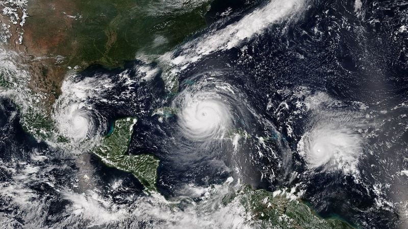
The combination of the colder atmospheric air and warmer sea level waters in the Atlantic Ocean last year resulted in the formation of intense storms, among them Maria, which according to new estimates from a Harvard study, resulted in over 4,600 deaths, widespread devastation and loss of power in Puerto Rico. Another storm Harvey flooded the Houston area while the remnants of Irma bore extensive damage to Georgia as a tropical storm.
Last year was an extremely active year, according to NOAA. The season produced 17 named storms, 10 of which were above Category 3. Six of those storms became major hurricanes that tore through the Gulf Coast and the Carribean leaving behind billions in damages and thousands in casualties.
“2017 saw a quarter of all historical category 5 landfalls. It was a pretty unlucky season for us,” said Timothy Hall, NASA scientist at the Goddard Institute for Space Studies. The season was ranked the 9th most active in history with last September becoming the most active month in history.
“It’s the few strongest landfalling hurricanes that do the vast amount of damage. If those storms are increasing in frequency, you could expect an increase in damages and casualties,” said Hall.
A consensus exists among climatologists of the correlation between increasing intensity of storms and climate change.
Hurricane Harvey, which flooded parts of Texas becoming the second costliest storm in U.S. history, made landfall in a small Texas town on the Gulf of Mexico last August.
According to Hall, between 20-to-38 percent of the rainfall accompanying the storm was attributed to the climate change.
“We now have the tools to estimate the fraction of this extreme event (storm) that is due to climate change and that is what we did with hurricane Harvey,” said Hall.
He said continued melting of ice sheets in the oceans is causing sea levels to rise and with that the growing potential of storm surges in Coastal cities resulting in more severe flooding.
According to Hall, hurricanes Katrina which hit New Orleans in 2005 and Sandy which made landfall in New Jersey in 2012 mirror the effects of rising sea levels and the increased damage storm surges could have on coastal cities.
“Eventually Katrina will become more common,” said Hall.
NOAA's outlook predicts 10-to-16 named storms this season, 5-to-9 hurricanes and 1-to-4 major category 3+ hurricanes with most of the activity expected during August and October.
Monahan said since its only possible to predict the path of a storm once it has formed in the Atlantic, it may be difficult to predict whether Georgia would be affected this season.
“We could have a very active season that doesn’t impact Georgia — it’s all luck of the draw on the weather pattern at a given time,” he added.
Like any disaster, hurricanes put human lives at risk, threaten infrastructure and result in devastation that could run into billions. Preparation is key in mitigating these risks.
Catherine Howden, the Chief of Staff at the Georgia Emergency Management & Homeland Security Agency (GEMA) said the agency is working with its partners in the state to put in place emergency plans to aide with recovery efforts in the event storms hit the state.
The agency is partnering with the Federal Emergency Management Agency (FEMA), local and state agencies, utility companies, law enforcement and non-profits to prepare for the season.
“All state resources are ready to be brought to use as needed,” said Howden.
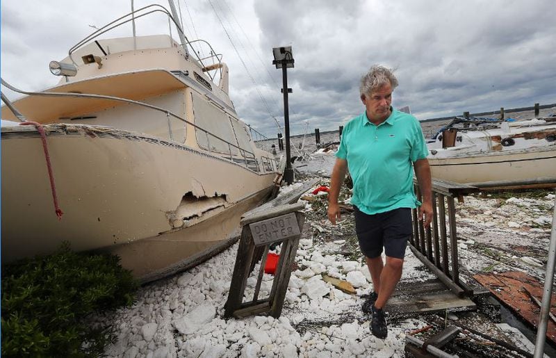
Last year, Irma caused extensive damage in the state, resulting in 3 confirmed deaths and a state of emergency declared by Governor Nathan Deal.
The hurricane which made landfall in September producing winds of up to 70 mph affected all the 159 counties in the state, cutting power for over 2.5 million customers and resulting in insurance claims worth over $700 million.
Within six months after the storm hit, FEMA reported $100 million in disaster relief to Georgians.
"As we have seen in the past it only takes one storm to cause major damage to the state," said Meredith Stone, a crisis communication specialist with Georgia Power.
Georgia Power estimates between $125 million to $140 million in damages from Irma. The company reported nearly 1,500 downed power lines, 2,400 fallen trees, 450 damaged transformers and 230 miles of damaged spans of wire.
With the effects of Irma still lingering in some parts of the state and Alberto, the first storm to make landfall this year, still causing flooding in some parts of North Georgia, federal and state agencies are reviewing their plans from last year to ensure streamlined operations this season.
“Alberto is already testing our plans,” said Stone.
Channel 2's Monahan however said no conclusions can be drawn from Alberto, which first made landfall in the Florida panhandle last week and dumped heavy rain as it made its way through the state.
“Alberto doesn’t necessarily mean “we’ll have a bad hurricane season.”
According to Stone, Alberto should be a good signal for Georgians and people living along coastal areas to start making their hurricane plans.
Various agencies in the state have put forth guidelines to help Georgians prepare for the season.
The messaging includes what to do before and after the storm, checking insurance coverage and preparing family safety kits.
The agencies stress effects of the Atlantic hurricane season are at times unpredictable and being prepared for the worst is key.
NOAA will issue an update on the season in early August as the peak of the season sets in.
“Even if scientists or forecasters tell you this oncoming season is going to be a weaker season, there is still a chance of getting a devastating landfall,” cautioned Hall.
Safety information before and after a storm
- Develop a safety plan for your family to include travel, accommodation and communication.
- Prepare an emergency supply kit with critical supplies that would last a couple of days.
- Watch for downed wires and trees.
- Never touch any downed wire or attempt to remove tree branches from power lines – they can kill.
- Don't step in standing water or saturated ground where downed lines may be present. They could be electrified.
- Avoid chain link fences. They may be electrified by a downed line out of sight and conduct electricity over great distances.
- Download apps to get up-to-date weather alerts.
SOURCE : Georgia Power
Facts about hurricanes
- Hurricanes were first named after the feast day for Catholic saints.
- The naming protocol changed in 1953 when the U.S. started using female names. This was later changed in 1978 to also include male names.
- The World Meteorological Organization is responsible for deciding storm names. The names are repeated every six years.
- Some of the hurricane names that have been retired include Katrina, Ike, Hattie and Opal
- The Atlantic Hurricane season runs from June 1 to November 30
Hurricane classification
- Category 1 - winds between 74-95 mph- Very dangerous winds that could cause some damage.
- Category 2 -winds between 96-110 mph — Extremely dangerous winds will cause extensive damage.
- Category 3 - winds between 11-129 mph — Devastating damage will occur
- Category 4 - winds between 130-156 mph — Catastrophic damage will occur
- Category 5 - winds between 157 mph or higher — Catastrophic damage will occur
SOURCE: NOAA


